Spatial class segregation
Date and country of first publication[1]
1985
Sweden
Definition
Spatial class segregation refers to the physical separation of different social classes within a given geographic area. This can manifest in various ways, such as through the clustering of wealthy individuals in affluent neighborhoods and the concentration of low-income families in disadvantaged communities. Spatial class segregation can result from economic disparities, historical patterns of exclusion and discrimination, and housing policies that perpetuate inequality. This phenomenon can have significant impacts on access to resources, opportunities, and social mobility for individuals from different socio-economic backgrounds.
See also
Related segregation forms
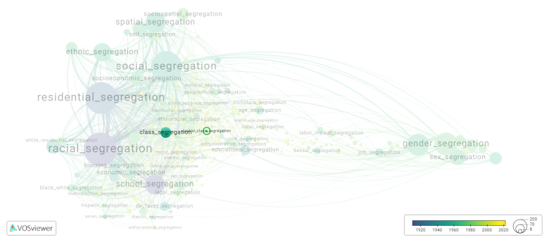
Spatial class segregation is frequently discussed in the literature with the following segregation forms:
This visualization is based on the study The Multidisciplinary Landscape of Segregation Research.
For the complete network of interrelated segregation forms, please refer to:
References
Notes
- ↑ Date and country of first publication as informed by the Scopus database (December 2023).
Spatial class segregation appears in the following literature
Reade E. (1985). Britain and Sweden: premature obsolescence of housing.. Scandinavian Housing & Planning Research, 2(1), 27-43. https://doi.org/10.1080/02815738508730057
Nesslein T.S. (1988). Urban decay and the premature obsolescence of housing: A cross country examination of the basic economic determinants. Scandinavian Housing and Planning Research, 5(4), 209-223. https://doi.org/10.1080/02815738808730166
Swanstrom T. (1999). The stubborn persistence of local land use powers: A comment on Morrill. Political Geography, 18(1), 25-32. Elsevier BV.https://doi.org/10.1016/S0962-6298(98)00061-4

