Immigrant spatial segregation: Difference between revisions
(Creating page) |
(Creating page) |
||
| Line 24: | Line 24: | ||
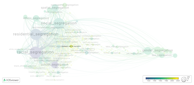
[[File:immigrant_spatial_segregation.png|780x780px]] | [[File:immigrant_spatial_segregation.png|780x780px]] | ||
This visualization is based on the study [[ | This visualization is based on the study [[Segregation_Wiki:About| The Multidisciplinary Landscape of Segregation Research]]. | ||
For the complete network of interrelated segregation forms, please refer to: | For the complete network of interrelated segregation forms, please refer to: | ||
Latest revision as of 07:17, 16 October 2024
Date and country of first publication[1][edit | edit source]
2012
Norway
Definition[edit | edit source]
Immigrant spatial segregation refers to the phenomenon where immigrants tend to settle in specific geographic areas within a country or city, often forming distinct communities or neighborhoods. This segregation can occur due to various factors, including economic opportunities, cultural familiarity, language networks, and social support systems.
Immigrant spatial segregation can have both positive and negative effects. On one hand, it can provide newcomers with a sense of belonging, cultural support, and access to services tailored to their needs. These immigrant enclaves may foster the preservation of cultural traditions and languages and facilitate social integration into the broader society.
However, immigrant spatial segregation can also lead to social and economic isolation, language barriers, and limited access to mainstream opportunities such as education and employment. Concentrated immigrant neighborhoods may face challenges such as poverty, crime, inadequate infrastructure, and discrimination.
Efforts to address immigrant spatial segregation often involve policies and programs aimed at promoting social integration, economic mobility, and inclusive urban development. These initiatives may include housing policies that encourage mixed-use and mixed-income neighborhoods, language and cultural integration programs, as well as efforts to combat discrimination and promote diversity and inclusion.
Synonyms[edit | edit source]
The following terms are synonymous with immigrant spatial segregation:
immigrants spatial segregation.
References and literature addressing this segregation form under these synonymous terms can be found below.
See also[edit | edit source]
Related segregation forms[edit | edit source]
Immigrant spatial segregation is frequently discussed in the literature with the following segregation forms:
This visualization is based on the study The Multidisciplinary Landscape of Segregation Research.
For the complete network of interrelated segregation forms, please refer to:
References[edit | edit source]
Notes[edit | edit source]
- ↑ Date and country of first publication as informed by the Scopus database (December 2023).
At its current state, this definition has been generated by a Large Language Model (LLM) so far without review by an independent researcher or a member of the curating team of segregation experts that keep the Segregation Wiki online. While we strive for accuracy, we cannot guarantee its reliability, completeness and timeliness. Please use this content with caution and verify information as needed. Also, feel free to improve on the definition as you see fit, including the use of references and other informational resources. We value your input in enhancing the quality and accuracy of the definitions of segregation forms collectively offered in the Segregation Wiki ©.
Immigrant spatial segregation appears in the following literature[edit | edit source]
Cucca R. (2012). The hidden unwanted: Patterns of immigrants marginality in Copenhagen (Denmark) and Milan (Italy). Advances in Education in Diverse Communities: Research, Policy and Praxis, 8(), 465-488. https://doi.org/10.1108/S1479-358X(2012)0000008023

